

New research from Victoria University of Wellington has provided in-depth information about how the Earth’s mantle deep beneath the central North Island is melting.
The paper, published in the prestigious international journal Nature, examines the movements of the Earth’s crust and mantle in the region extending from Lake Taupo to the Bay of Plenty.
The research is based on data from Global Positioning System (GPS) sensors, which provide information on shifts in the horizontal and vertical positions of the region over the past decade.
“The region has some of the most prolific volcanic activity anywher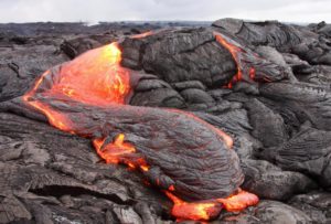 e in the world, but understanding what is causing this activity has proved to be tricky,” explains lead author Associate Professor Simon Lamb from Victoria’s School of Geography, Environment and Earth Sciences.
“In general, there is volcanic activity whenever there is molten rock at depth.
“So the volcanism seen in the North Island indicates a vast volume of molten rock beneath the surface, but we don’t really understand what is causing the melting, and how its presence controls movements of the Earth’s surface.
“Our study found a remarkably symmetrical and widespread pattern of movement extending for up to 150 kilometres laterally, which we would expect from a driving force deep in the Earth—nearly 20 kilometres underground, near the base of the crust.”
The deep movements gave the scientists a clue that the melting process itself is in the deep flow of the Earth’s mantle, says Associate Professor Lamb.
“Hot mantle rises up beneath regions of volcanic activity to reach levels where the pressure is much lower.
“It’s this drop in pressure that causes the melting.
“As this material flows, it creates a suction force that pulls down the overlying crust, but the strength of this force depends on how stiff or sticky the mantle rocks are.
“Our research showed that if the mantle’s rocks don’t contain much melt, they will be much stickier, causing the overlying crust to be pulled down rapidly.
“But if the rocks have just melted, then this makes the flow of the rocks runnier, effectively reducing the pull down force and allowing the overlying crust to spring back up again.
“Using the GPS technology we are now able to see directly where, when and by how much the underlying mantle is melting. This melt will eventually rise up through the crust to feed the overlying volcanoes.”
Associate Professor Lamb says it’s “amazing” that satellites can now be used to monitor the process of melting itself deep inside the Earth.
“This is something that might help us with assessing the likelihood of volcanic eruptions in the future.”
The paper was co-authored by Professors Tim Stern and Euan Smith from Victoria University, and Dr James Moore from the Earth Observatory of Singapore, Nanyang Technological University.
The GPS data used in this study was provided by the New Zealand GeoNet project and its sponsors—the Earthquake Commission, GNS Science and Land Information New Zealand.


